

|

Northshore Council PTSA is a welcoming organization that works to support our Local PTAs and serve the children and youth of our community through advocacy, collaboration, education, engagement, leadership, and mentorship.
|
Washington has the second highest risk in the U.S. of a large and damaging earthquake because of its geologic setting. The Pacific Northwest is Earthquake Country. The below video of the working session of the Cascadia Subduction zone gives information presented to our Washington planning and response committee.
1. Cascadia Subduction Zone (CSZ)
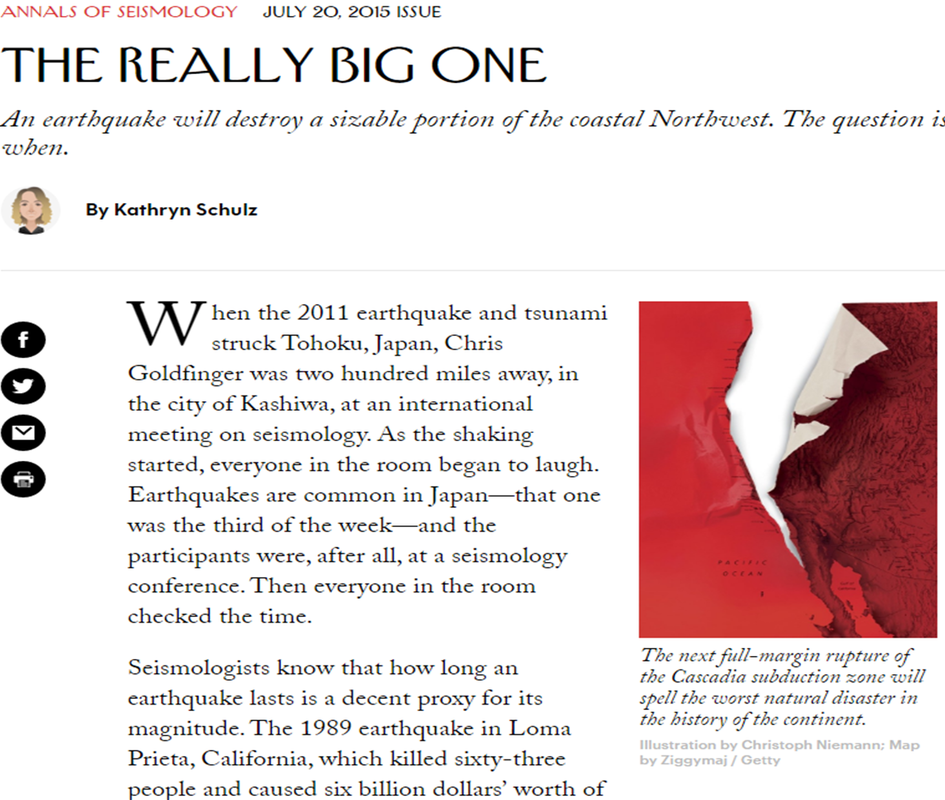
The Cascadia Subduction Zone (CSZ) is a 600-mile fault that runs from northern California up to British Columbia and is about 70-100 miles off the Pacific coast shoreline. In fact, "the Cascadia" has already made history, causing the largest earthquake in the continental United States on January 26, 1700. That's when the Cascadia unleashed one of the world's biggest quakes,thought to be about a 9.2 on the Richter scale, causing a tsunami so big that it rampaged across the Pacific and damaged coastal villages in Japan. Scientists say a quake of that size is due roughly every 300 to 500 years. The Cascadia Subduction Zone is an overlapping joint between tectonic plates, part of the Earth’s crust that floats on layers of molten rock. 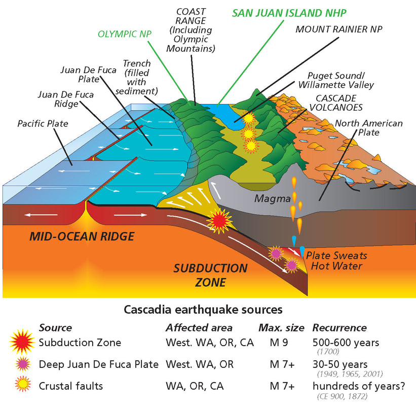
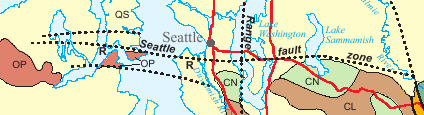
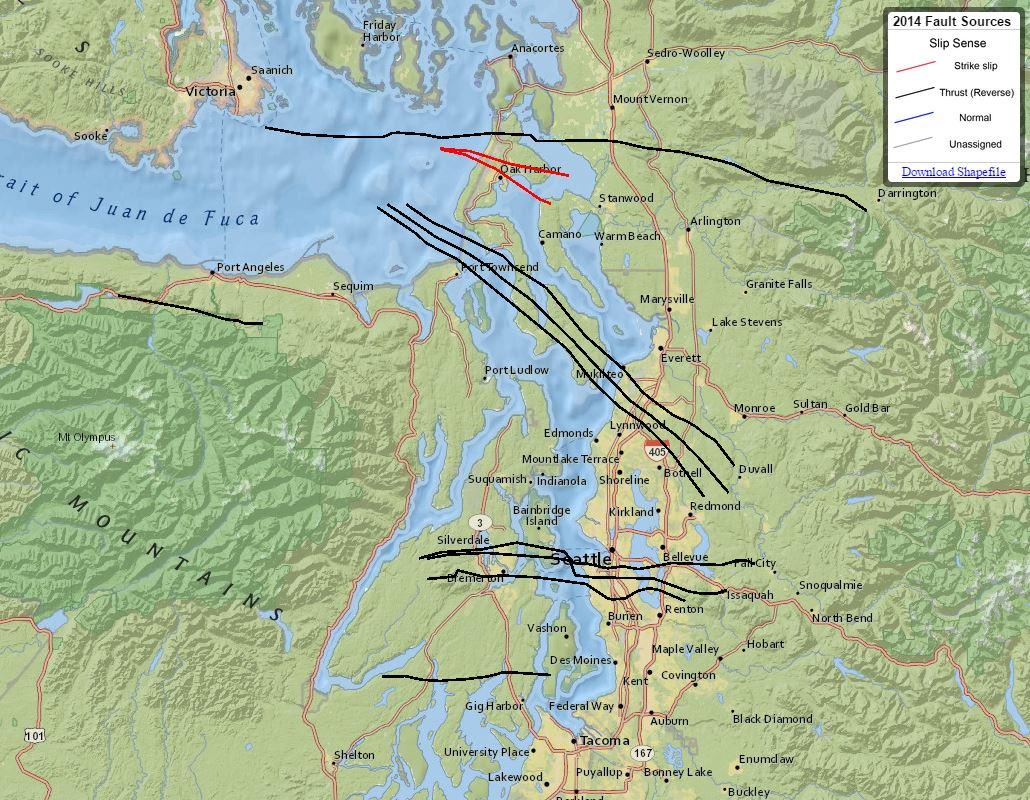
Click on Picture 2. Seattle FaultThe Seattle Fault is a zone of multiple shallow east-west thrust faults that cross the Puget Sound Lowland and through Seattle (in the U.S. state of Washington) in the vicinity of Interstate Highway 90.
It’s considered capable of a magnitude 7. That may not sound like much more than the magnitude 6.8 quake of 2001 based on the numbers, but that the Nisqually quake occurred some 30 miles underground. Then consider that the Seattle Fault is a complex of faults with various branches that run at or just below the surface.
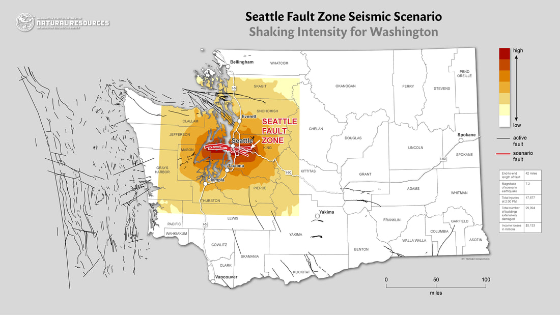
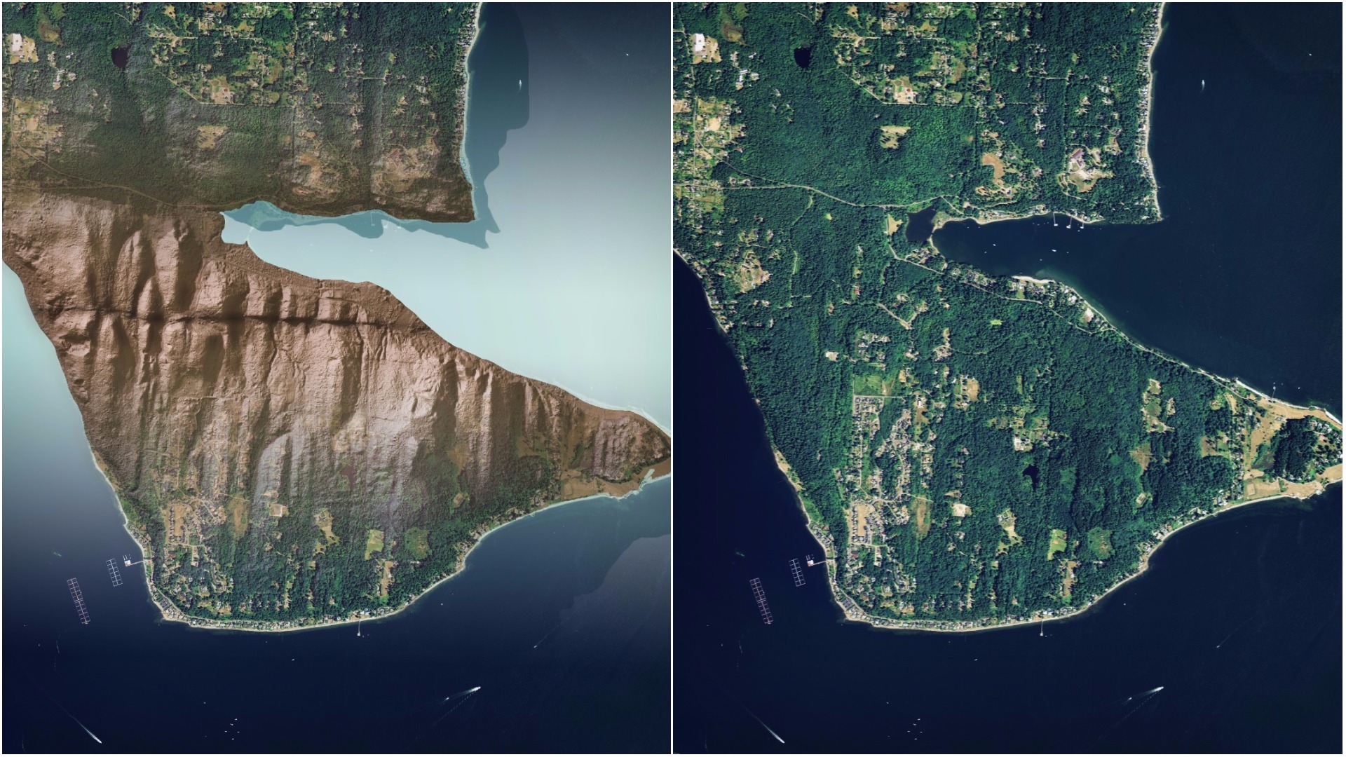
Across the northern portion of Bainbridge Island, light radar or lidar images taken from airplanes clearly show (below) what geologists say is the Seattle Fault running right on the surface. Another piece can be seen under the elevated lanes of northbound Interstate 5 in South Seattle not far from the Rainier brewery.
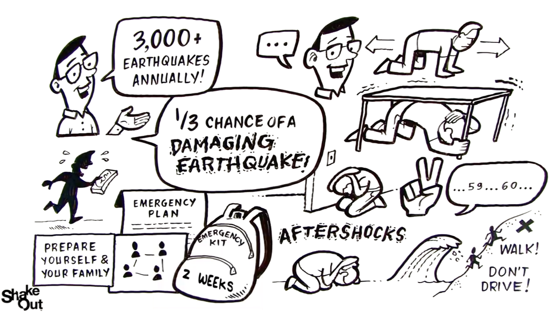
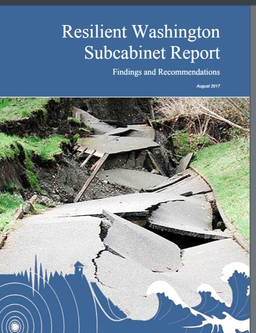
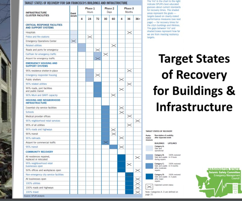
With the current preparedness levels of Washington State, we can anticipate being without services and assistance for at least 2 weeks, when the Cascadia Subduction Zone earthquake occurs. Our citizens, businesses, schools, government, and communities as a whole can take steps to get prepared. Take action now by actively planning and preparing yourself and your community to be ready for two weeks for disasters. READ MORE.... Resilient Washington SubcabinetOn November 4th, 2016, Gov. Jay Inslee issued Directive 16-19, establishing a Resilient Washington Subcabinet. Through this subcabinet, the Washington Military Department’s Emergency Management Division was directed to assess our strategy in creating a resilient Washington State with regard to the hazards posed by earthquakes and tsunamis. In addition, a general goal of the Directive was to increase individual, family and business preparedness.The Resilient Washington Subcabinet was convened in January of 2017 to help our state better prepare for natural disasters, including earthquakes, tsunamis, wildfires, drought, storms and flooding.
The subcabinet has been directed to:
|
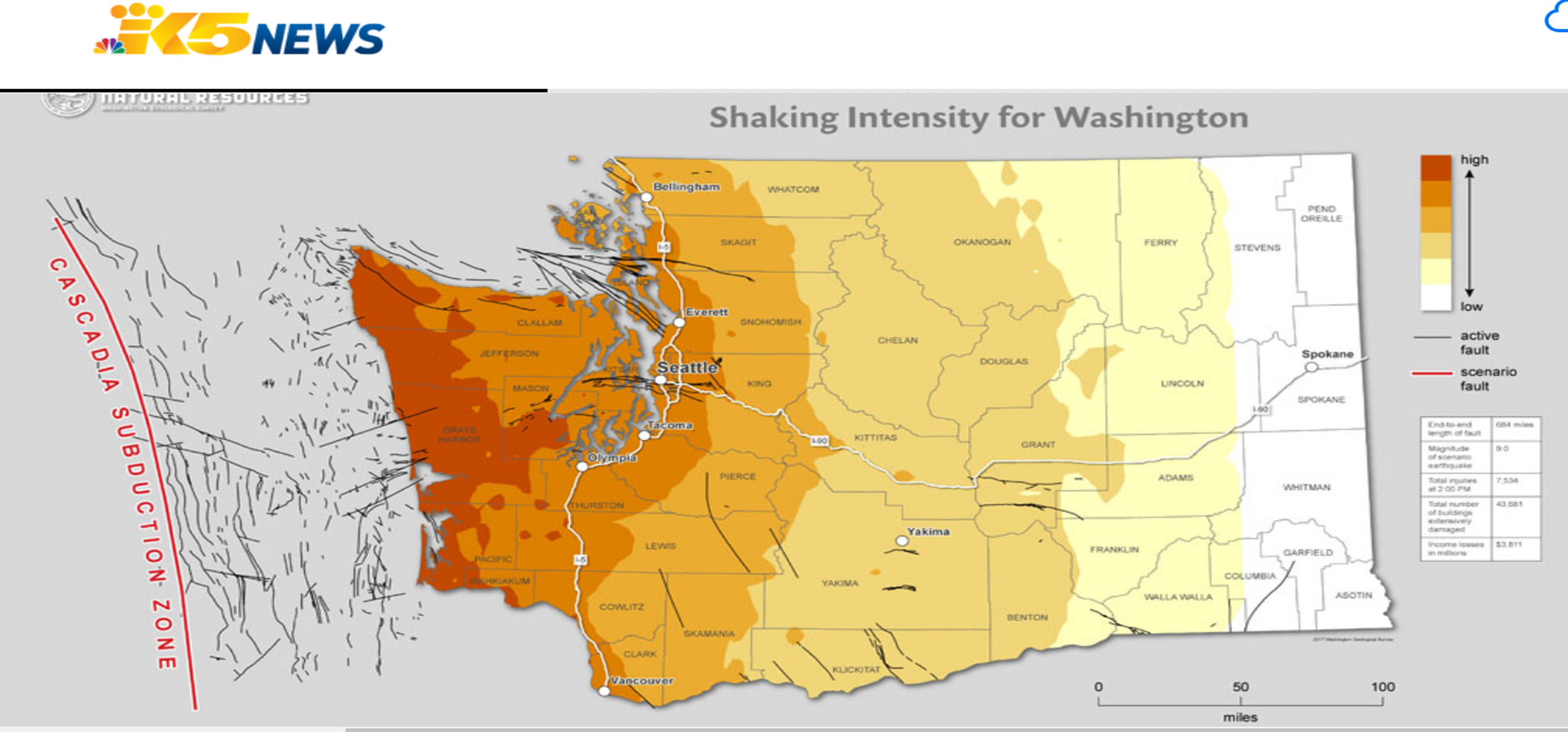
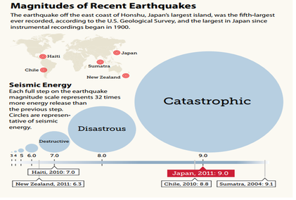
The Cascadia is capable of delivering a 9.0-magnitude quake. The quake of 9.0 is expected to last between 2 to 5 minutes and then a Tsunami of up to 50 feet in height that will impact the coastal area. Aftershocks of magnitude 7.0 or greater. Currently, scientists are predicting that there is about a 40 percent chance that a megathrust earthquake of 9.0+ magnitude in this fault zone will occur in the next 50 years. This event will be felt throughout the Pacific Northwest.
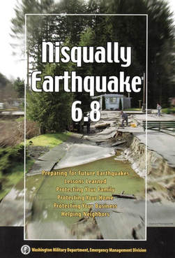
Nisqually Earthquake 6.8
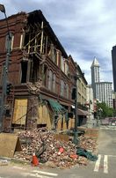
The Nisqually earthquake on February 28, 2001, was a 30 mile deep, magnitude 6.8, earthquake, lasted 40 seconds, 10 miles northeast of Olympia. One person died of a heart attack, hundreds were injured, and various estimates place damage at between $500 million and $4 billion. Exact figures are not available, as insurance claims information is not available.
Click on pictures

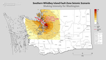
3. South Whidbey Island Fault (SWIF)The South Whidbey Island Fault is also dangerous. It’s significantly larger than the Seattle Fault, and South Whidbey could hand us a magnitude 7.5 earthquake. A 7.5-magnitude earthquake is capable of causing major destruction over a large area. It could also set off quakes on connected faults. Many of the other earthquake faults in the region could be connected to the South Whidbey in a system similar to the San Andreas fault in California. Because the South Whidbey fault is shallow, running beneath Mukilteo and southeast to Woodinville, south Snohomish County could be at increased risk, Snohomish County emergency services director John Pennington said.
“The reality is when this earthquake hits, there will be some heavy losses,” he said. Snohomish County is better prepared now for such a quake than it was several years ago, Pennington said. (Click on Pictures)
Bothell, WA has a very high earthquake risk, with a total of 983 earthquakes in the area since 1931. The USGS database shows that there is a 81.93% chance of a major earthquake within 50 Km (31 miles) of Bothell, WA within the next 50 years. The largest earthquake within 30 miles of Bothell, WA was a 5.8 Magnitude in 1996. (Click on picture)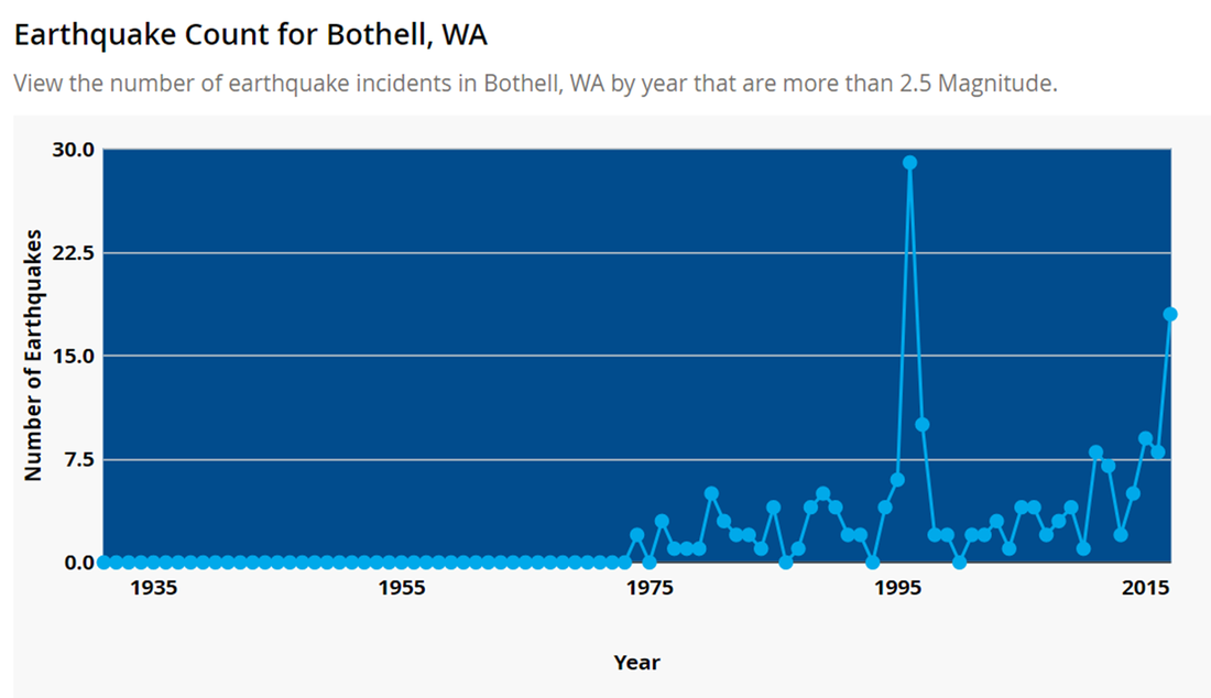
Volcanoes, Earthquakes, TsunamisMany thanks to Shannon Jephson-Hernandez, Grade 7 teacher, for her work with students regarding Volcanoes, Earthquakes, Tsunamis and Emergency Preparedness. Making a difference one student at a time!

(Click on Picture for more information) What to Expect (click on picture for article):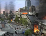
|
|
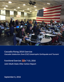
The complexity and duration of the Cascadia Rising 2016 Exercise provided an unprecedented opportunity to identify disaster operational best practices and lessons learned. Although the exercise evaluation was structured around six core capabilities, the findings presented transcended any single core capability. These strategic findings are highlighted here due to the breadth and severity of their impact on key response operations.
(Click on Picture to the left for report) |
Geologic & Seismic InformationThe Washington geologic information portal lets you look at specific locations and the types of possible risks e.g. earthquake faults, tsunami, land slide, volcano etc..
|
|
|
|
|

|